map

GUGPS: Global Urban Sprawling Map
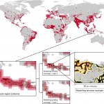
High-resolution Global Urban Sprawl Projection based on multiple applications of SLEUTH urban growth model (2019) Yuerong Zhou, Alvin C.G. Varquez, Manabu Kanda Full publication here. An annual dataset of global urban sprawl projection with 30 arc-seconds, around 1-km resolution, has been constructed.  Urban sprawling was projected using the SLEUTH urban growth model which utilizes historical […]
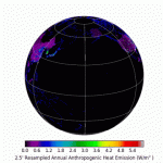
Anthropogenic Heat Flux Map (Dong et al., 2017)

Global anthropogenic heat flux database with high spatial resolution Y. Dong, A.C.G. Varquez, M. Kanda Atmospheric Environment (2017) http://dx.doi.org/10.1016/j.atmosenv.2016.11.040     A monthly-representative hourly dataset (currently in local time) of anthropogenic heat fluxes has recently been launched. We have stored geo-referenced tiffs with global coverage in a database free for anyone to download and use. […]